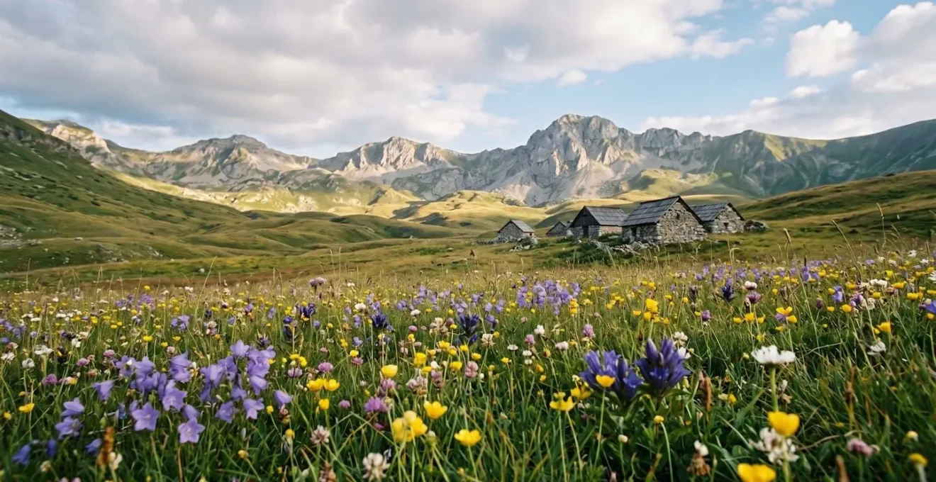
Shar Planina’s extraordinary biodiversity isn’t an accident; it’s the direct result of a unique convergence of geological history and specific climatic forces.
- The mountain range acts as a “glacial refugium,” a sanctuary where ancient plant species survived the Ice Ages.
- Its vast altitudinal range creates multiple distinct ecosystems, from sub-Mediterranean foothills to true alpine zones, all in one compact area.
Recommendation: For hikers and naturalists, this means every trail is a journey not just over land, but through distinct ecological chapters, offering a density of discovery rarely found elsewhere in Europe.
For British hikers and naturalists constantly scanning the map for Europe’s last wild frontiers, the 2021 designation of Shar Planina as North Macedonia’s newest national park was a significant event. While the broader Balkan region is known for its rugged peaks and warm hospitality, the name “Sharr Mountains” often evoked little more than a vague sense of remote, untrodden territory. Many articles will tell you it’s a new park, that it has high peaks, and that it’s a great place for an adventure. But this only scratches the surface.
To a field biologist, the declaration was the long-overdue recognition of an ecological treasure. The real question isn’t *what* is in Shar Planina, but *why* it is so uniquely rich. The answer lies not in simple species lists, but in a dramatic story of deep time, geological upheaval, and a unique climatic confluence where Mediterranean warmth meets continental rigour. This park is a living laboratory, and understanding the ecological engines that power its biodiversity transforms a simple hike into a profound natural history lesson.
This guide moves beyond the typical travel advice. We will dissect the ecological mechanisms that make this mountain range a biodiversity hotspot, compare it to its neighbours for different wildlife experiences, and provide practical advice for exploring its trails, all from the perspective of understanding the vibrant landscape itself. It’s an invitation to see the mountain not just as a destination, but as a complex, living system.
Contents: Unveiling the Ecological Secrets of the Sharr Mountains
- Why Does Shar Planina Host Over 2,000 Plant Species on Its Slopes?
- How to Organise a 3-Day Hut-to-Hut Trek in Shar Planina?
- Shar Planina vs Mavrovo: Which Park Offers More Wildlife Sightings?
- The Border Mistake: Which Trails Are Too Close to Kosovo for Solo Hiking?
- When Is the Alpine Flower Bloom at Its Peak in Shar Planina?
- Why Does Shar Planina Host Over 2,000 Plant Species on Its Slopes?
- Why Is the Flora of Galicica Considered Unique in Europe?
- Which National Park in North Macedonia Fits Your Hiking Style?
Why Does Shar Planina Host Over 2,000 Plant Species on Its Slopes?
The staggering botanical wealth of Shar Planina is not a matter of chance, but the direct outcome of three powerful ecological forces acting in concert. Firstly, its geographical position creates a dramatic climatic confluence. Here, the mild, humid air of the Mediterranean collides with the harsher, drier continental climate of the Balkan interior. This creates a mosaic of microclimates across different valleys and faces of the mountain, allowing plants with vastly different needs to thrive in close proximity.
Secondly, the park exhibits immense altitudinal zonation. A hiker can travel from oak and beech forests in the lower reaches, through a belt of coniferous trees, and up into vast alpine meadows and rocky scree above 2,000 metres. Each zone functions as a distinct habitat, supporting its own specialised community of plants. This layering effect multiplies the number of available ecological niches. It’s this concentration of life that led the UN Environment Programme to note that a staggering two-thirds of North Macedonia’s plant species are found within this single mountain range.
Finally, the complex geology, a mix of limestone and silicate rock, provides different soil chemistries, further diversifying the floral potential. This unique combination of factors has made the park a sanctuary for ancient and specialised life. As one biodiversity assessment highlights:
Thanks to more than 1500 vascular plant species, of which about 20% are endemic and rare and relic Balkan species, the Sara National Park makes one of the most important biodiversity protected areas in the Central Balkans.
– Panacomp – Sara National Park documentation, Sara National Park biodiversity assessment
How to Organise a 3-Day Hut-to-Hut Trek in Shar Planina?
The most immersive way to experience Shar Planina’s layered ecosystems is on a multi-day, hut-to-hut trek. This classic European hiking style allows you to travel deeper into the wilderness without the burden of a heavy tent and supplies, relying instead on the network of mountain huts for shelter and a taste of authentic Balkan hospitality. These huts, or ‘planinski dom’, are often simple, but provide a warm bed, hearty meals, and an invaluable connection with local mountaineering culture.
A classic and highly rewarding 3-day itinerary connects the Ljuboten area with the park’s highest peaks. This route offers a complete cross-section of the park’s landscapes, from forests to high alpine ridges. Here is a typical plan:
- Day 1: Popova Shapka to Ljuboten Hut. The trek begins at the ski resort of Popova Shapka (1,700m). From here, an 11km trail winds through forest and open pastureland to the iconic Ljuboten Mountain Hut (1,630m). This leg takes around 4.5 hours and serves as a perfect acclimatisation day.
- Day 2: Ascent of Titov Vrv. This is the main challenge. From the hut, you’ll tackle the demanding 20.9km Shar Planina Summit loop, a full day’s effort of over 8 hours, ascending to the summit of Titov Vrv (2,747m), the highest peak entirely within North Macedonia. The terrain is rocky and exposed, offering breathtaking panoramic views.
- Day 3: Return to Popova Shapka. The final day involves a descent via high ridgeline trails and through vast alpine meadows, completing the circuit back to the starting point. It’s a day for savouring the expansive vistas you earned the day before.
Your 5-Point Shar Planina Trek Readiness Audit
- Route & Permits: Have you mapped your exact route, identified water sources, and checked if any special cross-border permits are needed for your chosen trail?
- Gear Check: Does your gear list include essentials for mountain weather (waterproofs, layers, sun protection), a reliable navigation tool (GPS/map), and a first-aid kit?
- Hut Logistics: Have you contacted the mountain huts (like Ljuboten) to confirm they are open and to book your space, especially during the peak season of July-August?
- Physical Conditioning: Does your fitness level match the daily distances and elevation gains (often 1000m+ per day)? Have you trained with a weighted pack?
- Emergency Plan: Have you shared your itinerary with someone back home and do you have the contact numbers for local mountain rescue services?
Shar Planina vs Mavrovo: Which Park Offers More Wildlife Sightings?
For any naturalist, the prospect of wildlife sightings is a thrilling part of exploring a new park. In North Macedonia, the two largest parks, Shar Planina and Mavrovo, offer distinct opportunities. While both host impressive fauna, including large carnivores like bears and wolves, the *probability and style* of sightings differ dramatically due to their core topography. Shar Planina is a park of open ridgelines and vast alpine meadows, while Mavrovo is dominated by deep, dense forests. This fundamental difference dictates the best strategy for wildlife observation.
In Shar Planina, your best tool is a pair of binoculars and patience. The open terrain means animals are visible from a great distance. Finding a vantage point at dawn or dusk and scanning the high pastures can yield sightings of chamois, which number around 720 in the park. In Mavrovo, a park with a significant population of 70 brown bears, the strategy is one of stealth and luck. Sightings are more likely on silent hikes along forest trails near water sources, but the dense canopy means encounters are often closer and more fleeting. As one guide notes for Mavrovo, there’s a “decent chance of spotting deer or chamois, with bears and wolves staying mostly out of sight.” The critically endangered Balkan lynx is a resident of both, but sightings are exceptionally rare and a matter of pure serendipity. The following table breaks down the comparison for the aspiring wildlife watcher.
This comparative data, drawn from an analysis of North Macedonia’s parks for backpackers, highlights the strategic differences in wildlife spotting.
| Wildlife Category | Shar Planina | Mavrovo |
|---|---|---|
| Large Carnivores | Bears, wolves, Balkan lynx (critically endangered, rare sightings) | 70 brown bears, wolves (more densely forested habitat) |
| Ungulates & Chamois | 720 chamois in national park, open high-altitude spotting | Chamois, deer, wild goats in forested slopes |
| Bird Species | 128 species including raptors on exposed ridges | 140+ species including hawks, eagles, vultures in forest canopy |
| Terrain Type | Open ridgelines, alpine meadows (dawn/dusk binocular viewing) | Dense forests, river valleys (silent trail tracking required) |
| Sighting Strategy | Use binoculars at dawn/dusk on exposed ridgelines | Silent hiking on forest trails near water sources |
The Border Mistake: Which Trails Are Too Close to Kosovo for Solo Hiking?
The idea of a “border mistake,” where a hiker might inadvertently and dangerously stray into Kosovo, is a notion largely rooted in the region’s past, not its present reality. While the Shar Planina range forms a natural and political border, today it is less a line of division and more a model for transboundary cooperation. The fear of poorly marked or hazardous border zones is outdated, primarily thanks to the development of one of Europe’s most ambitious long-distance trails.
The modern story of this border is one of connection, not conflict, and it is best told through the success of the High Scardus Trail. This project transformed a sensitive region into a celebrated hiking destination.
Case Study: The High Scardus Trail – A Transboundary Success Story
The High Scardus Trail exemplifies safe, managed cross-border hiking. This epic route, which won the Best European Tourism Project in 2022, traces the borders of North Macedonia, Kosovo, and Albania as part of a major conservation initiative. With Kosovo having been declared landmine-free in 2001, the trail now operates with official waymarkers, a network of local guides, and established protocols for administrative crossings. Far from being a “mistake,” hiking these border ridges is the very purpose of the trail, celebrating peace and shared natural heritage. According to a report by National Geographic, it represents the successful transformation of former conflict zones into peaceful destinations.
The scale of this project is immense; the main trail covers 225 miles (362km) through 20 stages connecting 6 national parks, with Shar Planina at its heart. For the solo hiker, this means the primary concern is not physical danger but administrative awareness. While many sections require no special procedure, certain crossings may require pre-arranged permits. The key is to plan ahead by consulting the official High Scardus Trail resources or hiring a local guide who understands the current regulations. The “border mistake” is not one of geography, but of failing to prepare.
When Is the Alpine Flower Bloom at Its Peak in Shar Planina?
For the botanist or naturalist, timing a visit to Shar Planina is crucial, as the mountainsides transform into a vibrant canvas of colour during the alpine bloom. This is not a single event but a rolling wave of florescence that moves up the mountain as the snow recedes. Understanding this altitudinal progression is key to witnessing the bloom at its most spectacular.
The floral display begins in the lower meadows and progresses to the highest peaks over several months. While specific timings can shift year to year, especially with a changing climate, a general calendar helps in planning a botanical-themed trek. The period from late June to late July is generally considered the sweet spot for maximum diversity and intensity above the treeline.
- Early Bloom (May-June): As winter’s grip loosens, the first wildflowers appear in the foothills and lower meadows. This is the time for spring species as the landscape greens up below 1,500 metres.
- High Alpine Peak (July): This is the main event. Above the treeline, the alpine meadows erupt in a riot of colour. This is the best time to find endemic species like the Sharr Horehound (Marrubium scardicum) and the Scardic Crocus (Crocus scardicus) in full glory. Daytime temperatures are pleasant, typically between 15-22°C.
- Late Season Surprises (August): While the peak has passed, August brings its own rewards. Specific high-altitude specialists, such as certain gentians and saxifrages, have their moment on the most exposed, rocky peaks.
- A Note on Climate Change: It is crucial to recognise that these timelines are becoming less predictable. Consulting local guides or recent posts on hiking forums for real-time conditions is highly recommended before booking a trip focused on the bloom.
Why Does Shar Planina Host Over 2,000 Plant Species on Its Slopes?
Beyond the broad geological and climatic drivers, the richness of Shar Planina’s flora is truly understood when you focus on its unique and protected species. The park isn’t just a container for a large quantity of plants; it’s a specialist nursery for life forms found nowhere else on Earth. These endemic species are the living jewels in the park’s crown, each a product of millennia of isolation and adaptation to very specific conditions on the mountain’s slopes. Species like the Sharr Horehound (Marrubium scardicum) or the delicate Sharr violet are the tangible result of the ecological forces at play.
The designation as a national park provides a critical shield for this fragile biodiversity. The primary role of the park authority is to balance human activity—from pastoralism to tourism—with the imperative of conservation. One of the main threats is not large-scale development, but subtle changes in land use. For example, the decline of traditional grazing can lead to scrub encroachment on alpine meadows, choking out delicate, light-dependent wildflowers. Conversely, overgrazing can damage sensitive plant communities.
For the visiting naturalist, this means hiking with an awareness of this delicate balance. Sticking to marked trails, practicing leave-no-trace principles, and supporting local conservation efforts through park fees or hiring accredited guides are direct contributions to preserving the very biodiversity one has come to admire. The park is a testament to the fact that conservation is an active process, not a passive state. It is the ongoing effort to protect these 2,000+ species that gives the park its true meaning.
Why Is the Flora of Galicica Considered Unique in Europe?
Just as Shar Planina showcases biodiversity through sheer scale and altitudinal range, Galicica National Park, further south, demonstrates it through immense evolutionary depth. The uniqueness of Galicica’s flora is inextricably linked to its position between two of Europe’s most ancient lakes, Ohrid and Prespa. Lake Ohrid in particular, formed 2-3 million years ago, acts as a living museum of evolution, and its climatic influence is profound.
The mountain itself functioned as a crucial glacial refugium during the Ice Ages. While glaciers scoured much of Europe, erasing ecosystems, the specific combination of Galicica’s topography and the humidity from the ancient lakes created a sanctuary. In this refuge, “relict” plant species survived when their relatives elsewhere went extinct. Hiking in Galicica is therefore like walking through a botanical history book, encountering plants that are living fossils of a bygone era.
Furthermore, the mountain creates starkly different microclimates on its eastern and western slopes. The Ohrid-facing side has a sub-Mediterranean character, while the Prespa side is more continental. This, combined with the classic altitudinal zonation from lakeside to summit, creates an incredible concentration of ecological zones. A hiker can start amongst sub-Mediterranean scrub and, in just a few kilometres of ascent, pass through forest belts to true alpine flora at the peak. This dense layering of distinct ecosystems, packed into such a small area and laden with relict species, is a phenomenon rarely seen in Europe and is the primary reason Galicica’s flora is considered so exceptionally unique.
Key takeaways
- Shar Planina’s exceptional biodiversity is not random; it’s a predictable result of its unique geology, climate confluence, and altitudinal range.
- Hut-to-hut trekking is the most effective and immersive way to experience the park’s layered ecosystems, from forests to alpine meadows.
- Effective wildlife spotting requires different strategies in different parks; Shar Planina rewards open-ridge scanning, while Mavrovo requires silent forest tracking.
Which National Park in North Macedonia Fits Your Hiking Style?
Ultimately, for the visiting hiker and naturalist, the “best” national park is a subjective choice that hinges entirely on your personal hiking style and interests. North Macedonia is blessed with several world-class parks, each offering a distinct character and experience. Are you a summit-chaser seeking high-altitude challenges and vast panoramas? A forest mystic who prefers the silence of ancient woods? Or a botanist explorer, for whom the richness of the flora underfoot is the main attraction?
Shar Planina, with its high peaks like Titov Vrv and its unparalleled plant diversity, is the premier destination for the summit chaser and botanist who enjoys open, expansive terrain. Mavrovo, with its deep forests and higher density of large mammals, appeals more to the forest mystic and wildlife tracker. Galicica offers a uniquely compressed botanical journey for the dedicated botanist explorer, while Pelister provides its own unique appeal with its endemic pines and famous glacial “eyes”.
To help you align your personal hiking archetype with the right destination, the following table provides a clear, at-a-glance comparison of the country’s main national parks.
| Park | Hiker Archetype | Trail Infrastructure | Access from Skopje | Key Features |
|---|---|---|---|---|
| Shar Planina | The Summit Chaser | Marked trails, mountain huts (Ljuboten, Smreka) | 40km to Tetovo base | Titov Vrv (2,747m), 2,000+ plant species, chamois sightings |
| Mavrovo | The Forest Mystic | Moderate marking, guesthouse network | Western region, bus access | Deep forests, 70 bears, Mount Korab (2,764m) |
| Galicica | The Botanist Explorer | Well-marked ridge trails | Via Ohrid (160km) | Double lake views, relict flora, altitudinal zonation |
| Pelister | The Botanist Explorer | Established paths, hut system | South via Bitola | Endemic Macedonian pine, twin glacial lakes |
Now equipped with this ecological understanding of North Macedonia’s incredible natural assets, the next logical step is to choose your trail, lace up your boots, and plan your own adventure into the wild heart of the Balkans.