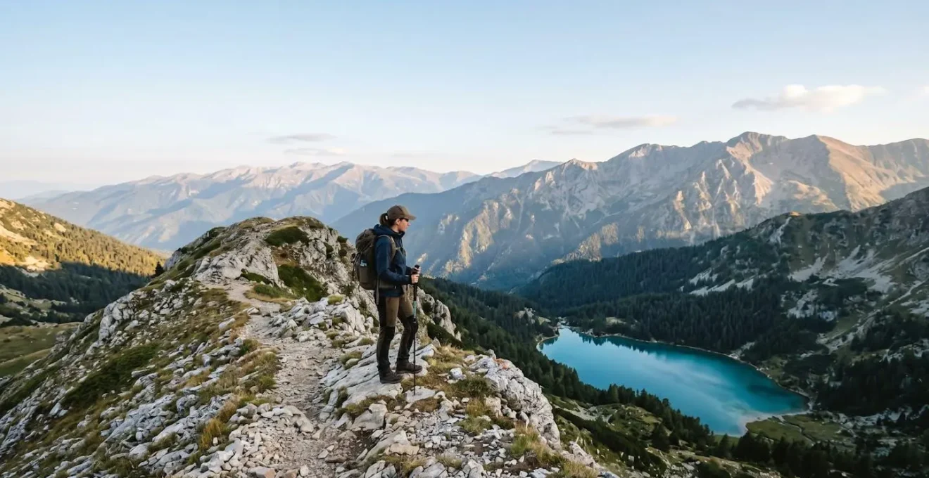
Choosing the right trail in North Macedonia is less about difficulty and more about matching the park’s “character” to your own spirit of adventure.
- Beginner-friendly Pelister offers clear trails and classic alpine views, while Mavrovo provides more landscape variety and lakeside scenery.
- Advanced treks like the High Scardus Trail demand total self-sufficiency, a mental and logistical challenge far beyond popular Alpine routes.
Recommendation: Use this guide to assess your personal need for infrastructure, solitude, and navigational challenge before you lace up your boots.
The call of the Balkan mountains is strong. You look at a map of North Macedonia, a country where jagged peaks seem to outnumber cities, and the question isn’t *if* you should hike, but *where*. Many guides will throw names at you: Mavrovo, Pelister, Galicica. They’ll show you pictures of pristine lakes and sweeping vistas, and list the most popular trails. But from my post as a ranger, I see hikers arrive with expectations set by a photo, not by the reality of the trail. They’ve chosen a path that doesn’t match their skills, their gear, or more importantly, their spirit.
The common advice—”wear good boots,” “bring water”—is just the start. True preparation goes deeper. It’s about understanding the land you’re about to walk on. This isn’t just about choosing a park; it’s about choosing an experience. Do you want the comfort of well-marked paths and a mountain hut, or does the thrill of navigating a wild, remote ridgeline call to you? The key to an unforgettable Macedonian hike isn’t just picking the prettiest peak. It’s about honestly assessing the unique trail character of each park and finding the one that speaks to you.
This guide is my attempt to share that deeper knowledge. We’ll compare the welcoming slopes of the beginner-friendly parks, uncover the secrets of our unique ecosystems, and discuss the unwritten rules of mountain safety here. We’ll then tackle the ultimate challenge, the High Scardus Trail, and dissect what it truly takes to prepare. My goal is for you to step onto the trail not just as a tourist, but as a conscious visitor who understands and respects the wild heart of this country.
To help you navigate this decision, this guide breaks down the key questions every aspiring hiker in North Macedonia should ask. From beginner choices to expert expeditions, consider this your personal briefing before you head for the mountains.
Contents: A Ranger’s Briefing on North Macedonia’s Parks
- Mavrovo vs Pelister: Which Park Offers Better Landscapes for Beginners?
- Do You Need an Entry Permit to Hike in National Parks?
- Why Is the Flora of Galicica Considered Unique in Europe?
- The Campfire Mistake That Is Strictly Prohibited in Dry Season
- When Is the High Scardus Trail Finally Snow-Free for Hiking?
- Mavrovo vs Pelister: Which Park Offers Better Landscapes for Beginners?
- Is the High Scardus Trail Harder Than the Tour du Mont Blanc?
- How to Prepare for the High Scardus Trail Trekking Adventure?
Mavrovo vs Pelister: Which Park Offers Better Landscapes for Beginners?
This is the first question I’m often asked by those new to our mountains. Both parks offer incredible beauty, but their “character” is distinctly different, catering to different types of beginners. Mavrovo is sprawling and diverse, a world of rolling hills, dense forests, and the vast, serene Mavrovo Lake. Pelister, on the other hand, is a more classic, concentrated alpine experience, defined by its rocky peaks and iconic glacial lakes.
To put it simply: if you’re a beginner who wants variety, lakeside views, and doesn’t mind trails that feel a bit wilder and less manicured, Mavrovo is an excellent choice. If you’re a beginner who wants a true taste of the alpine environment—with granite peaks, unique pine forests, and the security of well-marked paths—then Pelister is your perfect starting point. The trek to Pelister’s “Eyes,” two glacial lakes, is a rewarding 15km round trip that offers a full-value mountain day without overwhelming technicality.
The best way to understand the difference is to look at the practical details a hiker needs to know. This table, based on countless hours on these trails, breaks down the key features for a first-timer. It highlights how Pelister’s more developed infrastructure and clear paths make it a slightly more straightforward choice for those new to mountain hiking, as confirmed by an analysis of beginner-friendly features.
| Feature | Mavrovo National Park | Pelister National Park |
|---|---|---|
| Trail Markings | Less marked, requires GPS navigation | Well-marked paths, easier to follow |
| Typical Distance | 14 km round trip (Mavrovo Lakes Trek) | 15 km round trip (Pelister Peak) |
| Elevation Gain | ~400 meters | ~450 meters |
| Trail Character | Wilder, less-marked, requires self-reliance | Accessible, clear paths, steadier climbs |
| Key Scenery | Lake Mavrovo, forested slopes, Mt. Korab views | Alpine lakes (Pelister’s Eyes), Molika pine forests, mountain vistas |
| Infrastructure | Ski resort nearby, fewer services on trails | Visitor center, more established support |
| Best For | Beginners seeking variety and lakeside relaxation | Beginners wanting alpine character with clear trails |
Do You Need an Entry Permit to Hike in National Parks?
Yes, and it’s one of the most important contributions you can make to the preservation of these spaces. Think of the entry fee not as a ticket, but as an investment in the future of the wilderness you’re about to enjoy. North Macedonia’s national parks typically require a small entrance fee, which is collected either at a main gate, a ranger station, or a designated visitor center. For example, in Pelister, you’ll find the main visitor center near the start of many popular trails, making the process simple and straightforward.
This fee, usually just a few euros, is critical. It directly funds the park’s conservation efforts: trail maintenance, habitat restoration for species like the Balkan lynx, scientific research, and the salaries of the rangers who keep these areas safe and protected. When you pay this fee, you are actively participating in our Leave No Trace ethos. It’s the first and easiest step in ensuring these mountains remain pristine for generations to come. So, always plan to have a small amount of local currency (Macedonian Denar) on hand, and view this small transaction as part of your hiking ritual.
Failing to pay the fee isn’t just about breaking a rule; it’s about withholding support from the very ecosystem that provides you with so much. These entrance points are gateways to a protected world, and the permit is your key, signifying you understand and respect the pact between visitor and nature. Keep your receipt with you during your hike, as rangers may perform checks on the trail.
Why Is the Flora of Galicica Considered Unique in Europe?
Galicica National Park holds a special place in the heart of any botanist or nature lover. Its uniqueness doesn’t come from a single rare flower, but from its incredible biodiversity, a direct result of its extraordinary location. The mountain ridge of Galicica acts as a massive natural barrier, sandwiched between two of Europe’s oldest and deepest tectonic lakes: Lake Ohrid and Lake Prespa. This unique geography creates a collision of climates. Warm, sub-Mediterranean air sneaks up from the south via Albania, while a harsher continental climate dominates from the north. The result is a mosaic of microclimates across the mountain.
As you hike from the shores of Lake Prespa up and over the ridge towards Lake Ohrid, you are literally walking through different climate zones. This has allowed an astonishing variety of plant life to flourish here, creating a living laboratory of evolution. The park is a haven for relict species—plants that have survived since the Ice Age—and a stunning number of endemic species, plants found nowhere else on Earth. The park’s official biodiversity assessments confirm this, documenting over 1,600 vascular plant taxa, with 12 species being local endemics. This means that on the slopes of this one mountain, you can find plants that exist only here.
For a hiker, this isn’t just an abstract scientific fact. It’s a tangible experience. You’ll notice the flora change as you climb, from lakeside reeds to oak forests, then to beech forests, and finally to high-altitude alpine meadows bursting with color in the spring and summer. This botanical richness is what makes Galicica more than just a hike; it’s a journey through geological time and a testament to the power of nature’s creativity. When you walk here, you walk through a gallery of living art that is truly unique in a European context.
The Campfire Mistake That Is Strictly Prohibited in Dry Season
From a ranger’s perspective, there is no more terrifying sight than a plume of smoke rising from a remote valley in August. The single biggest mistake a visitor can make, one that is strictly and unconditionally prohibited, is lighting an open campfire during the dry summer months. Our summers are hot and dry, and the landscape becomes a tinderbox. A single stray ember from a poorly managed fire can ignite a catastrophe, destroying ancient forests and threatening wildlife, villages, and human lives.
The danger is not theoretical. North Macedonia has faced devastating fire seasons. In the summer of 2024 alone, a report from the European Forest Fire Information System stated that more than 85,000 hectares burned across the region. This is why the rule is absolute: no open fires. This includes small “cooking” fires. The romantic image of sitting around a crackling campfire must be replaced with the reality of our fire-prone climate.
The responsible alternative is simple and effective: a portable camping stove. Modern canister or liquid fuel stoves are lightweight, efficient, and infinitely safer. They provide a contained flame, leave no scar on the landscape, and can be extinguished instantly. Using a stove is a core tenet of our risk mitigation strategy in the backcountry. When you choose a stove over a fire, you are making a conscious decision to protect the forest.
Respecting the fire ban is the most critical rule of our summer backcountry. It also means being vigilant. If you see an unattended or illegal fire, report it to the park authorities or emergency services immediately. Your vigilance could save a forest. Remember, the warmth of a campfire is fleeting, but the scar of a wildfire can last for centuries.
When Is the High Scardus Trail Finally Snow-Free for Hiking?
The High Scardus Trail (HST) is not a casual walk; it’s a high-altitude traverse across the spine of the Balkans. The number one factor governing its accessibility is snow. Thinking you can hike it “early” in the season is a dangerous assumption. As a ranger, I see the remnants of winter’s grip long after the calendar says it’s summer. The ideal, and safest, hiking window for the entire HST is frustratingly short but firm: from late June to early October.
Attempting the trail before late June is asking for trouble. You will almost certainly encounter significant, deep snowfields on high passes and north-facing slopes. These snowfields are not just fluffy powder; they are often hard, icy, and extremely dangerous to cross without an ice axe, crampons, and the skills to use them. A simple slip can result in an uncontrollable slide. Furthermore, melting snow saturates the ground, turning trails into muddy trenches and swelling rivers into hazardous crossings.
By early July, the sun has typically done its work, the vast majority of the trail is clear, the ground has firmed up, and the high alpine meadows are in full bloom. This is when the trail truly comes alive. The season extends through August and September, which often offer the most stable weather. By mid-October, the risk of the first major autumn snowstorms increases dramatically. Being caught in a blizzard at 2,500 meters is a life-threatening situation. Heed the mountain’s schedule, not your own. Patience is a critical piece of gear for any HST hiker.
Mavrovo vs Pelister: Which Park Offers Better Landscapes for Beginners?
We’ve looked at the data, but choosing a park is also about feeling. As a ranger, I encourage new hikers to think about the *kind* of quiet they are seeking. The experience of walking in Mavrovo is fundamentally different from that in Pelister, even if the trail distances are similar. Your choice should reflect the experience you want to have.
Mavrovo’s landscape offers a gentle, unfolding beauty. The trails often wind through deep beech and fir forests, opening up suddenly to vast meadows with views of distant peaks. The constant presence of the lake in the valley below gives the park a feeling of spaciousness and calm. It’s a park for the contemplative beginner, one who enjoys the journey as much as the destination and finds peace in the changing scenery—from forest floor to lakeside shore. The wilderness-feel here is more pronounced, even on easier trails, which can be both a thrill and a responsibility.
Pelister, by contrast, presents a more dramatic, immediate sense of being “in the mountains.” The climb starts, and you are quickly in an alpine world. You are surrounded by the scent of the endemic Molika pine and the sight of granite boulders. The trail is a clear objective, leading you upward to a defined goal—the peak or the glacial lakes. It’s a park for the goal-oriented beginner, one who draws energy from seeing the summit get closer and wants that classic, rugged mountain photo. The infrastructure here provides a safety net, allowing you to focus on the physical challenge and the stunning alpine scenery.
Is the High Scardus Trail Harder Than the Tour du Mont Blanc?
This is a crucial question, and the answer is an emphatic “yes”—but not in the way most people think. Physically, if you can hike the Tour du Mont Blanc (TMB), you likely have the fitness for the High Scardus Trail (HST). The difficulty is not in the legs; it is in the head and in your backpack. The TMB is a “Type 1” difficulty: physically demanding but logistically simple. The HST is a “Type 2” difficulty: physically demanding AND logistically and mentally complex.
The TMB is a beautifully orchestrated wilderness experience. You can hike from hut to hut with a light daypack, enjoy a hot meal every night, and follow impeccable signposts through bustling alpine towns. Getting lost is difficult. Finding water or food is easy. The HST is true wilderness. It requires total self-sufficiency. Waymarking can be sparse or non-existent for long stretches, making GPS navigation an essential lifeline, not a backup. Resupply points are days apart and offer limited options. You will experience profound solitude, a wonderful gift that also means you are entirely on your own if something goes wrong.
This comparative analysis from seasoned Balkan trekkers makes the distinction clear: where the TMB scores 10/10 for logistical ease, the HST scores a 3/10. This is the true measure of its difficulty. One of the most visceral examples of this “Type 2” difficulty is dealing with local realities, such as encounters with shepherd dogs—a challenge completely absent on the TMB. These are not pets; they are fierce, territorial livestock guardians. An account from hikers on the HST vividly illustrates this unique challenge.
Case Study: Shepherd Dog Encounters on the High Scardus Trail
Hikers crossing the Macedonian highlands frequently encounter shepherd dogs, a major source of anxiety. One documented incident involved nine mastiffs surrounding campers, becoming aggressive when trekking poles were raised defensively. The hikers took refuge behind their tent wall until shepherds arrived. Another encounter was managed using a small alarm device, which successfully calmed the dogs. The correct shepherd dog protocol involves staying calm, avoiding eye contact, and waiting for the shepherd’s intervention rather than trying to intimidate or outrun the animals.
Key Takeaways
- Park choice is personal: Match the trail’s “character” (infrastructure, wildness) to your hiking style.
- Safety is paramount: Adhere strictly to the summer fire ban and understand local challenges like shepherd dogs.
- The High Scardus Trail is a test of self-sufficiency, demanding expert navigation and logistical planning far beyond typical alpine treks.
How to Prepare for the High Scardus Trail Trekking Adventure?
Preparation for the High Scardus Trail is an exercise in meticulous planning and building redundancy into your systems. This is not a trail where you can “wing it.” Your safety depends on your gear, your skills, and the foresight you apply long before you take your first step. Two areas are absolutely non-negotiable: navigation and resupply strategy.
First, navigation redundancy is not optional; it is the cornerstone of your entire trek. Technology can and does fail. Batteries die in the cold, screens break in a fall, and satellite signals can be lost. You must have a three-tiered system. Your primary tool will be a dedicated GPS device with the full trail route pre-loaded. Your backup is your smartphone with offline maps. Your ultimate fail-safe is the analog system: a full set of physical, waterproofed maps and the knowledge to use them with a compass. Mastering this trinity is the single most important skill for the HST.
Second, your resupply strategy dictates the rhythm of your entire journey. You cannot assume you’ll find a store whenever you need one. You must meticulously map out the villages along the route, like the crucial stop in Brod, and understand what they offer. A hiker’s report on resupply options on the HST highlights that while you can find basics like pasta, fruit, and sweets, the selection is limited. You must plan your food carries for multi-day stretches between these points. This might involve carrying 4-5 days of food at a time, a significant weight consideration. For the most remote sections, some trekkers even arrange food drops in advance. This level of logistical planning is what separates a successful trek from a dangerous ordeal.
Your Non-Negotiable Navigation Plan
- Primary System: Load the complete, verified High Scardus Trail GPX track onto a dedicated, robust GPS device. Mark all known water sources, shelters, and potential exit routes as waypoints.
- Secondary System: Download offline topographic maps for the entire region onto your smartphone using a reliable app (e.g., Maps.cz, OsmAnd). Ensure your phone is fully charged and carried with a backup power bank.
- Analog Fail-safe: Carry a complete set of physical, waterproof-treated maps of the trail. Pack a reliable baseplate compass and, crucially, ensure you have practiced using them together before the trip.
- Pre-Trek Systems Check: Before leaving home, test every piece of your navigation kit. Confirm that the GPX files load correctly, that offline maps are fully downloaded, and that all batteries are fresh. This is not the time for surprises.
- Emergency Skillset: The final layer of safety is your own knowledge. Take a course or practice basic map-and-compass navigation. Understand how to triangulate your position and how to re-route in an emergency. Your brain is your ultimate backup.
Now you have the ranger’s briefing. You understand the character of our parks, the weight of your responsibilities, and the true nature of the challenges ahead. The mountains are waiting. Plan with respect, prepare with diligence, and walk with awareness. Your journey begins now.