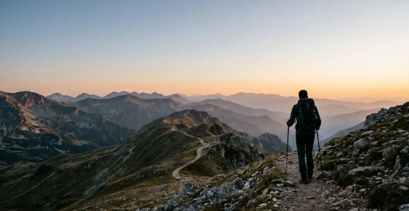
Success on the High Scardus Trail hinges not on fitness alone, but on mastering logistical autonomy in Europe’s last true wilderness.
- Unlike the Alps, the primary challenges are navigating bureaucracy (border permits), managing risk in remote areas (weather, navigation), and carrying region-specific gear.
- The trail demands a mindset shift from consumer of a well-serviced trek to a self-sufficient expedition leader.
Recommendation: Prioritize your logistical and risk-mitigation planning over pure physical training; your autonomy is your primary safety tool.
For the seasoned trekker who has conquered the Tour du Mont Blanc, stared down the GR20, and found their rhythm on the Laugavegur Trail, the question always arises: what’s next? The answer may lie in a rugged, sprawling range that forms the wild heart of the Balkans: the High Scardus Trail. This is not just another long-distance path; it’s a journey into one of Europe’s last untamed landscapes, a place where the infrastructure is minimal and the sense of adventure is maximal.
Many guides will give you the standard advice: get fit, break in your boots, pack layers. This is all true, but for a trekker of your experience, it’s rudimentary. The real preparation for the High Scardus Trail goes far beyond physical conditioning. It demands a fundamental shift in mindset from the well-oiled machine of the Alps to the raw, self-reliant reality of the Balkan highlands. The true challenge isn’t just the elevation gain; it’s mastering logistical autonomy, navigating cross-border bureaucracy, and mitigating risks in an environment that doesn’t offer the safety nets of more popular routes.
This guide is built on that premise. We will move past the basics and focus on the critical, region-specific details that will define your success and safety. We’ll dissect the trail’s true difficulty, demystify the border permit process, detail the essential, non-negotiable gear, and equip you with the knowledge to read the mountains and plan your resources like a true expeditionary. This is your technical and motivational briefing for an unforgettable adventure.
This comprehensive guide is structured to tackle every critical aspect of your preparation. From high-level comparisons to the granular details of permits and park selection, each section is designed to build your confidence and competence for this unique challenge.
Summary: A Technical Briefing for the High Scardus Trail
- Is the High Scardus Trail Harder Than the Tour du Mont Blanc?
- How to Organize Border Permits for the High Scardus Trail?
- Gear List: What Essential Items Must You Carry for High Scardus?
- The Weather Mistake: How to Spot Sudden Storms on Shar Planina?
- Where Can You Resupply Food and Water Along the High Scardus Trail?
- Is the High Scardus Trail Harder Than the Tour du Mont Blanc?
- Mavrovo vs Pelister: Which Park Offers Better Landscapes for Beginners?
- Which National Park in North Macedonia Fits Your Hiking Style?
Is the High Scardus Trail Harder Than the Tour du Mont Blanc?
This is the benchmark question for any experienced European trekker, but the answer is not a simple yes or no. On paper, the metrics can seem comparable. For instance, the classic Tour du Mont Blanc route covers 170 kilometers and 10,000 meters of cumulative elevation gain, figures that are in the same league as the High Scardus Trail’s core sections. However, equating them based on stats alone is a fundamental mistake. The difficulty is not in the numbers, but in the context.
The TMB is a highly-developed, world-famous route. You are rarely more than a few hours from a refuge offering a hot meal, a bed, and shelter. Signage is impeccable, trails are well-trodden, and a robust support infrastructure exists for baggage transfers and rescue. It is a managed wilderness experience. The High Scardus Trail, by contrast, is a raw, expedition-style trek. The true difficulty lies in its remoteness and lack of infrastructure. Huts are sparse, often basic shepherd shelters or guesthouses a full day’s trek apart. Way-marking can be inconsistent or non-existent for long stretches, especially on high border ridges. A demanding day on the TMB might end with a beer at a bustling refuge; a demanding day on the HST might end with you filtering water from a spring and pitching a tent in a silent valley, utterly alone.
Therefore, the High Scardus Trail is unequivocally harder for the trekker who relies on external support. It requires a higher degree of logistical autonomy, navigation skill, and mental resilience. The physical effort may be similar, but the weight of responsibility—for your route, your food, your safety—is significantly heavier. It’s a challenge not of the legs, but of the head.
How to Organize Border Permits for the High Scardus Trail?
Here lies one of the greatest logistical hurdles of the High Scardus Trail, a piece of “bureaucratic navigation” that is absolutely non-negotiable. The trail weaves across the borders of North Macedonia, Albania, and Kosovo. Crossing these borders in the high mountains, far from any official vehicle checkpoint, requires special hiking permits. Attempting to cross without them can result in fines, deportation, and the premature end of your trek. This process demands patience and meticulous planning, often starting two months before you set foot on the trail.
The process involves submitting detailed personal information and a precise hiking itinerary to the border police of each respective country. While it is technically possible to do this independently, the process is notoriously opaque and difficult for individuals to navigate. This is why most experienced trekkers opt to use a local tour operator. For a fee, these agencies leverage their direct contacts and experience to streamline the process, dramatically increasing the chance of success. According to Balkan trail specialists, border crossing permits cost approximately €5 per person per crossing, plus companies charge €20-35 per person for administrative services—a small price to pay for certainty.
The timeline is critical and unforgiving. You cannot organize this at the last minute. Below is a step-by-step guide to the permit application process, which underscores the need for advance planning. Remember, even with permits, you must carry your passport at all times.
- Day 60-45 Before Trek: Research your exact itinerary and identify all border crossing points with specific dates. The police require set dates, though they typically understand 1-2 day delays due to weather.
- Day 45-40 Before Trek: Gather all required documents for your group: full names, passport numbers, clear passport scans, and the detailed crossing schedule (location, date, approximate time).
- Day 40-35 Before Trek: Submit the formal permit applications to the border police of Kosovo, Albania, and North Macedonia. This is the stage where a local operator’s role is most valuable.
- Day 30-20 Before Trek: Follow up on applications if no response is received. Kosovo and North Macedonia are generally responsive; Albania can have slower response times.
- Day 20-10 Before Trek: Receive your permits. Kosovo often sends an electronic confirmation, while others might provide stamped documents or only verbal confirmation to your local agent.
- Day 5-0 Before Trek: Print all permit confirmations and save digital copies on your phone. It’s wise to also photograph the physical permits with your phone as a timestamped backup.
Gear List: What Essential Items Must You Carry for High Scardus?
For an experienced hiker, packing is second nature. However, the High Scardus Trail’s regional specificity demands a few critical items you won’t find on a standard Alpine gear list. Your equipment must be tailored to the challenges of remoteness, specific local hazards, and inconsistent terrain. A failure in your gear system here has far greater consequences than on a more populated trail. This starts with your navigation and communication setup, which must be treated as a single, redundant system.
Case Study: The High Scardus Navigation & Safety System
The High Scardus Trail’s extreme remoteness and patchy mobile signal demand a comprehensive navigation system. Experienced hikers who have completed the trail recommend a layered, redundant approach. This includes: a Personal Locator Beacon (PLB) or satellite messenger for emergency SOS communication, a high-capacity 20,000mAh+ power bank to keep devices charged over multi-day sections without electricity, a full set of printed paper maps of the region as a fail-safe, and a reliable compass for orientation on pathless ridges. While a GPS device or smartphone app is essential for primary navigation, prior experience navigating with them is crucial, as the faint trails and inconsistent way-marking are unforgiving.
Your navigation system is your lifeline. Auditing it before you leave is not optional. The following checklist will help you ensure your system is robust and ready for the demands of the trail.
Your Action Plan: Navigation & Safety Systems Audit
- Device & Power Check: Fully charge all electronics (GPS, phone, PLB, power bank). Test that the power bank correctly charges each device. Ensure you have the correct cables for everything.
- Software & Data Download: Download offline maps for the entire High Scardus region onto two separate devices (e.g., phone and GPS unit). Download the GPX tracks for your planned route from a reliable source.
- Redundancy & Analog Backup: Acquire and protect printed, waterproof maps for the entire trail. Confirm you have a reliable, liquid-filled compass and, crucially, that you know how to use it with the map.
- Communication Test: Activate and test your PLB or satellite messenger’s subscription. Send a test message to ensure it is functioning. Save emergency contact numbers both digitally and in a written, waterproof format.
- Field Competency Check: Go for a local hike and navigate using only your planned HST system. Can you follow a GPX track? Can you find your position on the paper map? This practice builds crucial confidence.
Beyond navigation, three other items form a “Balkan Trekking Triangle” of essential gear:
- Robust Water Filter: This is non-negotiable. The landscape has extensive livestock grazing, and you will be drinking from springs and streams shared with animals. A filter rated for bacteria and protozoa (like a Sawyer Squeeze or Katadyn BeFree) is critical to avoid debilitating illness.
- Ultrasonic Dog Deterrent: Encounters with large, aggressive, semi-feral shepherd dogs are a well-documented reality on this trail. These lightweight devices emit a high-frequency sound that deters dogs without harming them, providing a crucial layer of protection and peace of mind.
- Metal-Tipped Trekking Poles: Leave the rubber tips at home. The terrain is a mix of steep, slippery grass, loose scree, and muddy shepherd paths. The bite of metal tips is mandatory for stability and safety.
The Weather Mistake: How to Spot Sudden Storms on Shar Planina?
The Shar Planina, or Shar Mountains, form a significant portion of the High Scardus Trail and are notorious for their volatile and rapidly changing weather. Exposed for long stretches above the treeline, these vast, rolling highlands offer little to no natural shelter. The most common and dangerous mistake trekkers make is misjudging the speed at which a pleasant morning can turn into a life-threatening electrical storm. Unlike the Alps where a forecast might hold for the day, here you must become your own meteorologist, constantly reading the sky and terrain.
The key is to understand the typical pattern: clear mornings followed by the rapid convective build-up of cumulus clouds over the peaks, often culminating in violent thunderstorms in the early to mid-afternoon. The golden rule for any high-altitude traverse on this trail is to be up, over, and descending before noon. Pushing for a summit or continuing along an exposed ridge after 11 AM is a gamble you cannot afford to take. You must learn to recognize the early warning signs and act decisively, not hopefully.
To move beyond guesswork and into a structured risk-mitigation strategy, experienced guides use an “Observation-to-Action” protocol. This decision matrix helps you translate what you see in the sky into a concrete, safety-oriented action on the ground. There is no room for ambiguity when a storm front is approaching.
| Observation | Your Situation | Action Required |
|---|---|---|
| Rapid build-up of tall, puffy cumulus clouds over peaks after 11 AM | On an exposed ridge or approaching a high pass | Immediate Descent. Do not attempt the summit or traverse. Begin descending to the nearest valley or treeline immediately. |
| Dark, threatening clouds gathering from the west | Mid-slope or in an alpine meadow | Seek Shelter. Identify the nearest safe shelter (hut, dense forest, low gully) and move towards it. Prepare rain gear. |
| Lens-shaped (lenticular) clouds forming over ridges | Planning your day’s hike | Postpone High Passes. Expect extremely high winds on all ridges and passes. Alter your route to stay at lower elevations. |
| A sudden, noticeable temperature drop (5°C+ in under an hour) | Any location | Imminent Storm. A cold front is arriving. Seek shelter instantly. If thunder is heard, avoid open ground and single trees. |
| A consistent drop in pressure on your barometric watch | At camp in the evening | Plan for Deterioration. Weather will likely worsen within 6-12 hours. Plan for a rest day or a very early start to beat the incoming weather. |
Where Can You Resupply Food and Water Along the High Scardus Trail?
On a trek defined by logistical autonomy, managing your food and water supplies is paramount. The High Scardus Trail is not the Camino de Santiago; you cannot expect to find a shop or cafe in every village. Resupply points are few, far between, and require careful planning. You must adopt the mindset of carrying what you need, treating every resupply opportunity as a bonus, not a certainty. Generally, you should be prepared to carry 3 to 4 days of food between reliable resupply points.
Resupply opportunities fall into two categories. First, there are a few larger villages or small towns directly on or near the trail (like Galičnik in Mavrovo or Valbona in Albania, though the latter is more developed due to the Peaks of the Balkans trail). These may have a small shop with basic provisions like pasta, bread, and cheese, but do not expect a supermarket with specialized hiking food. Second, and more commonly, your resupply will come from pre-arranged stays at guesthouses. These family-run establishments are the lifeblood of the trail, providing hearty home-cooked meals for dinner and breakfast, and often a packed lunch for the next day. You must book these in advance and communicate your dietary needs. They are your primary source of calories and cultural immersion.
Water is more plentiful, with numerous springs and streams along the route. However, as mentioned in the gear section, the entire region is used for grazing. All water must be treated as contaminated. Never drink directly from a source without filtering or purifying it first. A reliable water filter is not just gear; it’s your health insurance policy on the trail. During hot summer months, some higher ridges can be dry, so it is essential to consult your map and plan your water carries accordingly, sometimes needing to transport 2-3 liters at a time between reliable sources.
Your strategy should be to start each multi-day leg with a full supply of high-calorie, lightweight hiking meals, and then supplement this with whatever fresh items you can procure. This hybrid approach ensures you are always self-sufficient but can also enjoy the local hospitality and reduce your pack weight when the opportunity arises.
Is the High Scardus Trail Harder Than the Tour du Mont Blanc?
We’ve established that the High Scardus Trail’s difficulty transcends simple metrics of distance and ascent. To truly prepare, we must delve deeper into the psychological and logistical challenges that define this trek, aspects that make it a fundamentally different and, for some, harder endeavor than its Alpine counterparts. The challenge is less about pushing through physical pain and more about maintaining composure in the face of uncertainty.
The first psychological weight is isolation. On the TMB, you are part of a moving community. You share the trail, the views, and the refuges with dozens of other hikers. This creates a powerful, albeit often unspoken, sense of shared safety. On the High Scardus Trail, you can hike for an entire day, or even multiple days, without seeing another trekker. This solitude is a huge part of the trail’s appeal, but it also means that you are entirely self-reliant. A twisted ankle is not an inconvenience; it’s a serious incident requiring a self-rescue or the activation of your emergency beacon. This constant, low-level awareness of your remoteness requires significant mental fortitude.
The second challenge is navigational ambiguity. While the TMB is marked like a city marathon, the HST demands active, constant route-finding. Faint shepherd’s paths that disappear into grassy meadows, confusing trail junctions with no signage, and long, pathless stretches across high plateaus are common. This requires you to place unwavering trust in your map, compass, and GPS skills. Every day involves a series of small but critical navigational decisions. This mental overhead, the constant “am I on the right track?” cross-check, is fatiguing in a way that simply following a well-marked path is not. Your preparation must include not just possessing the tools, but being mentally prepared to be the sole arbiter of your direction for days on end.
Key Takeaways
- The High Scardus Trail’s difficulty lies in its remoteness and lack of infrastructure, demanding complete logistical autonomy, not just physical fitness.
- Meticulous advance planning for cross-border permits is an absolute, non-negotiable requirement for a successful and legal trek.
- Region-specific gear, including a robust water filter, an ultrasonic dog deterrent, and a redundant navigation system (PLB, power bank, paper maps), is critical for safety.
Mavrovo vs Pelister: Which Park Offers Better Landscapes for Beginners?
For trekkers looking for a “taster” of the High Scardus Trail or a less committing multi-day hike in North Macedonia, the choice often boils down to its two most famous national parks: Mavrovo and Pelister. While both offer stunning Balkan scenery, they have distinctly different personalities and cater to different types of beginner hikers. Your choice should depend on whether you are looking for vast, open spaces or more intimate, forested landscapes with clear objectives.
Mavrovo is characterized by its immense scale. It is a land of “The Grand Expanse”: vast, rolling high-alpine pastures, epic wide-open views that stretch for miles, and a feeling of being in a truly big-sky country. For beginners, the infrastructure around the Mavrovo Lake and ski resort provides an accessible entry point to the high country, often using ski lifts to bypass the initial steep ascent. Pelister, on the other hand, is more of an “Enchanted Forest”. It is known for its unique “stone rivers” (geological formations of boulders), its forests of endemic five-needle Molika pine, and its more intimate, mystical scenery. The trails are generally better marked, and the park’s proximity to the city of Bitola makes logistics and access significantly easier for those new to the region.
The following table, based on information from the official High Scardus Trail resources, breaks down the key differences for a beginner trekker:
| Criteria | Mavrovo National Park | Pelister National Park |
|---|---|---|
| Trail Marking Clarity | 3/5 (Moderate marking, some ambiguity) | 4/5 (Better marked main trails) |
| Short Loop Hikes (under 4 hours) | 4/5 (Multiple options from ski resort) | 5/5 (Excellent short routes to Pelister Eyes lakes) |
| Cell Phone Reception | 3/5 (Coverage in ski resort area, limited on trails) | 4/5 (Better coverage near Bitola) |
| Proximity to Major Town | Ski resort infrastructure, moderate access | Very close to Bitola (easy logistics and emergencies) |
| Landscape Personality | The Grand Expanse: vast rolling high-alpine pastures, epic wide-open views | The Enchanted Forest: unique stone rivers, endemic Molika pines, intimate mystical scenery |
| Best For | Hikers seeking expansive alpine meadows and big-sky trekking | Beginners wanting shorter hikes, cultural sites, and accessible nature |
To make this more concrete, consider these sample 2-day itineraries:
- Mavrovo 2-Day Taster: Use the ski lifts to access the high alpine zone. Day 1 involves a moderate ridge walk with sweeping mountain views, returning to resort accommodation. On Day 2, explore the alpine pastures and shepherd settlements before descending via the lift. This offers a taste of the “big-sky” feeling with a comfortable safety net.
- Pelister 2-Day Classic: On Day 1, undertake the classic, well-marked hike from near Bitola to the “Pelister Eyes” glacial lakes, passing through beautiful Molika pine forests and overnighting in a mountain hut. On Day 2, you can either attempt the summit of Mount Pelister or enjoy a gentle descent back to the city.
Which National Park in North Macedonia Fits Your Hiking Style?
Beyond just beginner-friendliness, selecting the right national park in North Macedonia is about aligning the landscape and trail infrastructure with your fundamental hiking persona. Are you seeking solitude, summits, or culture? Each park offers a world-class experience, but only if it matches your core motivation. Understanding your own hiking “why” is the final step in planning the perfect Macedonian adventure.
Hiker Personas Matched to Macedonian Parks
An analysis by adventure travel experts suggests matching hikers to parks by their primary motivation. The Solitude Seeker, who craves isolation and pristine wilderness, is best matched to the remote northern sections of Mavrovo National Park, with multi-day routes and wild camping potential. The Summit Bagger, who prioritizes peak achievement and technical challenge, will find Pelister National Park ideal, offering the accessible yet rewarding summit of Mount Pelister (2,601m). Finally, the Cultural Hiker, who values history and local interaction, should look to Galichica National Park. Its dramatic ridges high above UNESCO-listed Lake Ohrid offer views of ancient monasteries and traditional fishing villages, blending nature and heritage seamlessly.
This idea of cultural richness is not an afterthought; it is woven into the very fabric of the landscape. The mountains are not empty wilderness; they are a living cultural space. The food, the traditions, and the way of life change subtly from one valley to the next, offering a depth that goes far beyond the trail itself. As Kosovar mountain guide Uta Ibrahimi beautifully puts it, this diversity is found in the smallest details.
From one village to another in Sharr can be quite different. We have Sharr-y cheese, and even though the villages are so near to one another, the way that they make it is different; the way they fold the cheese; what kind of herbs they use.
– Uta Ibrahimi, Much Better Adventures
Ultimately, your choice of where to hike in North Macedonia should be a conscious one. Don’t just pick the park with the highest peak or the most famous name. Ask yourself what you truly want to experience. Do you want the silence of a vast, empty ridgeline? The satisfaction of standing on a hard-won summit? Or the warmth of a shared meal in a village that has practiced its traditions for centuries? The mountains hold all these possibilities.
Now that you are armed with the technical knowledge and the right mindset, the High Scardus Trail awaits. Your next step is to move from planning to action. Begin drafting your itinerary, researching local contacts for permits, and auditing your gear with this guide’s principles in mind. The adventure has already begun.